by
Liz Childers
Today is the finale in my three part series on camping applications available on the Droid market. These apps are the bad-boys that other apps wish they could be. Seriously, when I stumbled onto these, I was incredibly shocked that they were, one, amazing and, two, free. Taking any of these on a camping trip is like bringing along a super smart friend with a photographic memory, tracking skills, and the ability to know how to save your life in any situation.
MapDroyd
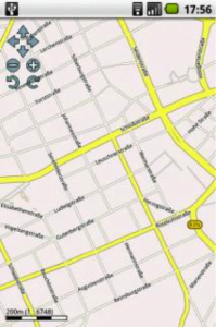
When you know you won’t have access to data connectivity, MapDroyd is an excellent tool. The application has maps for all the continents, except Antarctica, and for most island nations. Narrow your download choices to a single state or download maps of the whole world. The maps come in a highly compressed format and save to your storage card, so they won’t affect your phone’s speed. As long as you download before you head off on your Appalachian afternoon hike or your European backpacking extravaganza, you’ll have the detailed map you need without using any Internet or network connection.
U.S. Army Survival Guide
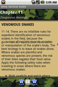
This is exactly what it sounds like. The entire U.S. Army Survival Guide is available for download on your Droid. There are 23 chapters and nine Appendices of quite literally everything you might need to know about survival. Topics range from survival in a nuclear environment to herbal medicines to different methods of stalking. It downloads to your phone’s storage card, so you can view it all offline. While I will never read through the entirety of this tome, it’s a great feeling to know I have a resource available to learn survival methods for any situation into which I could be thrown.
My Tracks
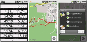
My Tracks enables you to record GPS coordinates, speed, distance, and elevation while you’re hiking, biking, running, or any other activity that you want to record. So, imagine that you’re about to start a hike you’ve never done before. Press record before starting you start out on the trail, and My Tracks displays your speed and elevation, while mapping your hike. Reach a really cool outlook during the hike? Put down a point marker on the map; you can also snap a picture and write a description of the location. When you finish your hike, stop recording. You can then name the track (whatever the name of the hike was) and list the activity (hiking). You can also put notes, like how strenuous the hike was. You can upload the track as a Google Doc. and as a Google My Map. As a Google Doc., you’ll have a spreadsheet recording of all your hikes, runs, trails, etc. As a Google My Map, you will have just created an actual map of your trail that you can share with friends. I thought this feature was especially great, if a friend has already hiked the area to which you are traveling; you can check out their recorded maps and see what hikes look good! (On a side note that can be really helpful for hikers, you can search in Google Maps for anyone’s uploaded maps; just type “hiking” along with the area to which you are traveling and select “user created content” from the drop down menu. This gives you everyone’s created maps of trails or anything else.)
OruxMaps
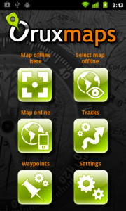
Like My Tracks, OruxMaps is a route logger for any and all outdoor activities. OruxMaps also shares the statistics logging features of the other app. The big difference, for me, was the easy way OruxMaps lets you download online maps or create your own maps so you can use them offline. This saves battery life and is great for longer hikes or runs.